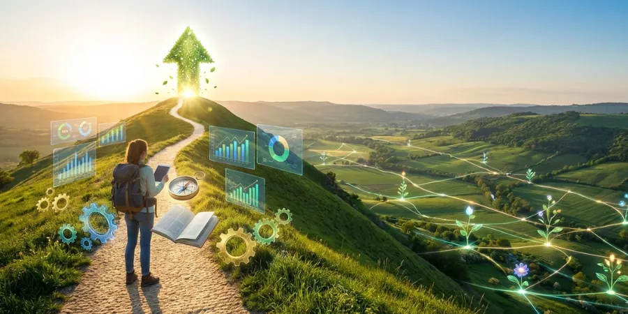
The world contains places that make you pause, take a breath, and feel truly alive. These places are so extraordinary that they join the ranks of the 7 Natural Wonders of the World. They are not buildings erected by human hands. Instead they are the result of Earth’s slow processes, dramatic forces, and boundless beauty. What this really means is that they offer something no photo or description can fully capture.
The 7 Natural Wonders of the World include spectacular sights on nearly every continent. Each one stands out not just for its scale, but for its story, power, and ability to inspire awe.
What Are the 7 Natural Wonders of the World?
1. The Aurora Borealis: Nature’s Celestial Light Show
When the night sky suddenly comes alive with streams of shimmering light, it feels as if the universe is performing just for you. The Aurora Borealis is not just beautiful. It is Earth’s most spectacular natural light show, a phenomenon that combines physics, space weather, and raw beauty.
What Are the Northern Lights
The Aurora Borealis, also called the Northern Lights, is a natural light display that appears in the high-latitude skies near the Arctic. It can range from soft wisps of color to vivid curtains and waves stretching across the sky. The name aurora borealis itself comes from ancient times. Aurora refers to the Roman goddess of the dawn, while borealis means northern wind. There is a southern counterpart called the aurora australis that appears near Antarctica.
People have described the aurora for centuries, but only in recent history has science explained it in terms we can truly understand. These lights are not random or magical in a mythical sense. They are a cosmic interplay between Earth and the sun.
How the Aurora Borealis Forms
At its core the aurora is science made visible, shaped by some of the most powerful natural forces of the Earth.
Solar wind is the name given by scientists to this phenomenon which involves constantly charged particles being emitted clockwise from the sun. These particles are able to travel a distance of millions of kilometers through outer space before finally reaching our planet. Earth has a magnetic field around it which acts as a shield and protects us from these charged particles to a big extent. At the poles, however, this magnetic field induces the particles to go up into the atmosphere through the lines of force which have already curved downwards.
Upon reaching the upper atmosphere the particles to the giants gas Adams and molecules. The energy of the gas atoms is increased by the collisions, and thus the atoms become excited. When the excited atoms lose energy, they do so by emitting a quantum of light. The light from various gases is in different colors. Typically, green and red lights are produced by oxygen while blue and purple shades are due to nitrogen.
So, it is true that the auroras are literally the atoms that have been energized by solar particles and then have released their energy in the form of light, a process analogous to the pulsing and glowing of colors in the sky.
Why the Lights Dance and Change
The aurora is a dynamic phenomenon; it moves, twists, and changes its shape since it is influenced both by Earth’s magnetic field and the changing stream of solar particles.
During the times when the sun is very active, particularly during solar flares and coronal mass ejections (the latter being a large release of plasma and magnetic field from the sun’s corona), a greater number of particles are transported to the Earth. This, in turn, leads to a higher level of auroral activity, and thus the lights becoming brighter, larger, or more widely seen outside the polar regions than usual.
The patterns arcs, curtains, ribbons, you observe are the results of the way the charged particles move along the magnetic field lines and their interactions with the gases in the atmosphere. The visual phenomenon is quite energetic since the stream of particles coming in is never of the same quality.
Where You Can See the Aurora Borealis
The aurora is strongest in a band around the poles called the auroral oval. In the Northern Hemisphere this covers parts of Alaska, northern Canada, Iceland, Norway, Sweden, Finland, and Russia.
These lights are most visible on dark, clear nights during the local winter months when the sun does not rise for long hours. That darkness gives your eyes a chance to see the faint glow turning into lively color.
Sometimes a strong geomagnetic storm pushes the aurora southward so it can be seen at lower latitudes. Historical records even describe spectacular auroras seen near the equator during extreme solar events.
What the Colors Mean
Color in the aurora is not random. It comes from specific interactions between charged particles and different parts of the atmosphere.
- Green:The most common auroral color. It comes from collisions with oxygen at heights around 100 kilometers.
- Red:Produced by oxygen higher in the atmosphere. It is rarer and appears at greater altitudes.
- Blue and Purple:Created by ionized nitrogen and seen at lower altitudes.
All of these colors appear when atmospheric atoms release energy after being excited. The mixture of particles, atmospheric conditions, and altitude determines the final shades you see in the sky.
When to See the Lights
The Northern Lights may be visible on any winter night if circumstances allow it. Although they are not limited to winter, it is during this time that they can be seen more often because of the long dark nights and dark skies.
One factor that determines the occurrence of auroras is the solar activity which is represented by various indices, one of which is the Kp index. During equinoxes which occur in March and September, the solar wind-Earth’s magnetic field interaction is usually stronger resulting in more aurora activity.
In addition, “patience” and “positioning” are two more factors that determine success in this case. The lights can hardly be seen or their colors can be washed out due to light pollution in cities. Going to places far away from artificial light, then making yourself comfortable in open places with a clear view and being patient increases your chance of witnessing a magnificent display of lights.
Aurora and Human Culture
For millennia, the auroras have impressed and inspired humans, who have invented different tales about them. The phenomena, depending on the civilization, were either the work of the spirits of the dead, gods or even the lights of the heavens merging together. The imagination and beliefs of different tribes were mighty but they often described the same feeling of amazement that was around the phenomenon.
Even in these modern times, the northern lights still hold the same power and attract photographers, scientists, and travelers, standing among the most breathtaking natural wonders of the world. Artists, scientists and nature lovers come together to witness the stunning scene and share their experience through words, photos and other forms of art. Many people travel to far places just to see the wonderful event and in the process create unforgettable memories and stories that link them to the divine above.
2. Grand Canyon (United States): Layers of Time
The Grand Canyon, situated in Arizona, is among the most extraordinary natural wonders of our planet. It is a huge canyon that the Colorado River has slowly but surely cut through over millions of years, thus showing the world the sedimentation of rocks that takes nearly two billion years of geological history to get down to the very bottom.
The canyon lies approximately 446 kilometers (277 miles) long, 29 kilometers (18 miles) in width at the widest point, and 1.8 kilometers (1 mile) deep at its deepest point.
The view at sunrise and sunset is amazing. The warm light that comes with sunrise and sunset goes around the canyon walls, thus red, orange, and gold colors are brought out distinctly. Hikers, as besides the rivers, continue to take trails going down the steep switchbacks. Birds of prey are seen circling high up in the sky. It is very easy to understand why the canyon feels like a living timeline of Earth’s past, making it one of the planet’s most striking geological wonders.
For most visitors, the Grand Canyon is a place where dramatic scale connects them deeply to the past, which is why it remains one of the defining natural wonders of the world.
How the Canyon Was Carved
The rock layers themselves, by no means, were the ones that produced the canyon. It was cutting power of water that gave the Grand Canyon its spectacular depth. The Colorado River has been the major architect of the canyon. The river around 5 to 6 million years ago started to cut down through the uplifted Colorado Plateau, thus revealing the layers created in different ancient environments.
Looking at it from a distance, millions of years can seem like an abstract notion. However, what is important is that the canyon’s depth was the result of a combination of uplift and erosion acting in concert. Tectonic forces gradually elevated the Colorado Plateau, which in turn provided the river with a steep gradient and velocity needed to penetrate deeper into the rock. The higher the plateau became, the more powerful was the river in terms of erosion.
The moment the river started cutting it was a matter of time before it reached the bottom. The combination of forces, namely, water, sediments, and gravity, gradually worked over a span of millions of years to give the canyon its present character of deep channels, wide areas, and sheer cliffs.
Among the other natural forces that contributed to the canyon’s development were seasonal floods, wind, and rain, which to a lesser extent, widened and shaped the canyon walls, thus exposing the intricate geologic layers that can be seen from the rims.
3. Great Barrier Reef (Australia): A Living Underwater World
The Great Barrier Reef is located off the coast of Queensland, Australia. It is the biggest coral reef system in the world, covering more than 2,300 kilometers (1,400 miles) along the entire northeastern coast. The reef consists of a large number of individual reefs, more than 2,000, and also contains countless islands, rather than being a single entity.
Underwater, dazzling coral gardens are alive with a variety of species, making the reef one of Earth’s richest biodiversity hotspots. Fish of various colors and sizes are constantly swimming among the coral, and the giant clams, sea turtles, and manta rays are all moving quietly through the currents. The vast range of species is one of the main reasons the reef is counted among the most significant world natural wonders.
The view from land is just as beautiful with tropical islands, white sandy beaches, and thick rainforest vegetation. The Great Barrier Reef is regarded as a natural wonder and an essential measure of the health of our seas at the same time.
Ancient Origins: How the Reef Began
The story of the Great Barrier Reef goes back millions of years, placing it among the planet’s most ancient natural formations. The formation of this extraordinary ecosystem started tens of millions of years back.
The late Oligocene epoch, approximately 25 million years ago, marked the period when the areas which later turned out to be the Reef were engulfed by a shallow sea. Corals and other organisms began to create underwater hills and platforms, just like in the previous deposits, which served as the base of the reef system of the future.
The tectonic plate of Australia was also a factor in the situation. The continent was moving northward gradually into the hotter and warmer tropical waters which was the perfect condition for the corals to thrive. The dead corals piled up over time creating natural ridges and walls. These layers acted as a hard surface where the new coral generations could attach and proliferate.
Ice Ages and Sea Levels: Building the Modern Reef
The present-day reef has not been formed in one go. It was developed and altered by the processes of the rising and falling of the sea levels that were caused by the glacial periods. The ocean level sank significantly during ice ages since the water was preserved in the ice sheets. The reef area was, therefore, mostly land. As the glaciers melted for thousands of years, the ocean level rose again. The corals grown in water followed the rising waters and built the reefs that were thousands of kilometers in length and height across the landscape that had been submerged.
The last 10,000 to 20,000 years have seen a gradual rise of the ocean finished with the last ice age. The ocean levels now being what we know they are, they have gone up and fallen back again. The corals have formed new colonies in these shallow waters, resulting in the formation of the extensive reefs that cover more than 2,300 kilometers along the northeastern coast of Queensland.
Indigenous Connection: The Reef Before Europeans
The Reef, long before the European explorers came to the scene, was the cultural background of the Indigenous Australians. The Aboriginal and Torres Strait Islander people have been familiar with the Reef for thousands of years and have been using its waters for fishing, penetrating its channels, and maintaining lively cultural relationships with the sea and islands nearby. The knowledge systems of such communities were around long before any written European records.
This past is seldom seen in early European maps, yet it is crucial to the understanding of the Reef’s place in human history. The Indigenous names for places, folklore about the marine life, and the practice of sustainable use all mirror the longstanding bond with the Reef ecosystem.
European Discovery and Early Records
The discovery of the Great Barrier Reef by Europeans was a very slow process. The Portuguese and Dutch explorers mentioned the northeast parts of the Australian coast only as well but did not write down anything concerning the Reef. The first European sighting of it happened at the end of the 18th century, and it was claimed widely at that time.
On June 6, 1768, Louis de Bougainville, a French explorer, approached parts of the reef system during his Pacific expeditions. Although, it was Captain James Cook’s 1770 voyage aboard the Endeavour that made the reef come into scientifically and globally recognized view. Cook’s vessel got stuck on what is now called Endeavour Reef. The crew had to do patchwork on the shore and got a very close experience with the reef structure. Later on, Cook discovered a narrow waterway that was then referred to as Cook’s Passage.
The other sea captains followed after him. William Bligh, who was mapping the routes through Torres Strait in 1792, helped with the reef passage maps by providing them with even more detailed information. The early European explorations initiated a long period of charting and mapping that was a prerequisite to later scientists and sailors being able to grasp the enormity and intricacies of the reef.
World Heritage Recognition and Modern Science
Scientists had a profound understanding of the functioning of coral reefs along with their dependency on climate and sea levels by the 20th century. The Great Barrier Reef was an area of marine biology research of great interest and its huge biodiversity made it one of the most researched ecosystems of Earth.
Being a UNESCO World Heritage Site since 1981 was due to its extraordinary universal value. This award underlined the ecological importance of the Reef, besides the necessity for its conservation.
Scientific knowledge still reveals newer things about Reef history and life. Genetic analysis of corals, impact on sea temperature and the Reef’s response to environmental changes are some of the focuses of their study.
4. Harbor of Rio de Janeiro (Brazil): A Natural Masterpiece
The first moment one sees the Harbor of Rio de Janeiro, he or she might think that this place is a mere picture and not a geographic feature. The harbor which is also called Guanabara Bay, is indeed a remarkable place that is very huge, and besides this, it has the elevation of the mountains around it and the granite peaks that are so dramatic. The Redeemer Christ is watching the whole area from the Corcovado mountain nearby.
The whole scene of water, jungle-covered hills, and city life creates one of the most dramatic natural landscapes on Earth. The harbor is a natural wonder because it presents a combination of huge geological structures with a huge amount of water, and in addition to that, it frames one of the liveliest cities on the planet.
Tourists can take in the splendid views, go for sail rides on the silent waters, or visit secret beaches. City Flivers meanwhile come here to have a glimpse of the breathtaking landscape.
Geographical Origins of the Harbor
The Harbor of Rio de Janeiro is, to all intents and purposes, the extensive and safe area of water that is Guanabara Bay. It is situated at the very edge of the Atlantic Ocean in Brazil and is surrounded by the cities of Rio de Janeiro, Niterói and other municipalities. The bay’s shallow entrance combined with the deep interior creates a perfect and natural shelter for ships against the open sea. It is oval in shape and has a circumference of about 31 miles (50 kilometers) with a very large depth range, thereby forming one of the natural harbors of the world.
The geological activity that has lasted for millions of years has given nature the power to define the area’s spectacular topography. The bay is bordered by mountains such as Sugarloaf and Corcovado that are the very tip of granite deposits that were once the very bottom of the ocean.
The exceptional situation is thus that a harbor appears both colossal and cozy, right in the middle of a natural surrounding formed by hills and water and so it is a harbor that feels both grand and intimate, set within a natural amphitheater of hills and water.
First European Contact and Naming
The very first encounter of Europeans with the harbor that was later known as Rio de Janeiro was on the 1st of January 1502, as per the records. During an exploratory voyage, the Portuguese navigators Gaspar de Lemos and Gonçalo Coelho arrived at the bay and at that moment, they thought the bay was the mouth of a river.
The word “river” in Portuguese is “rio” and the month of January is “janeiro”. Hence, they called it Ria de Janeiro (January stream or lagoon) initially. However, the confusion between the terms ria (lagoon) and rio (river) caused the name Rio de Janeiro to be first applied to the bay and then to the city that would arise on its banks.
Before the Europeans came, the Indigenous peoples like the Tamoio and Tupiniquim were already inhabiting the shores of the bay. They were very familiar with its waters, islands, and forests, and the bay was an integral part of their cultural and economic life long before it came to be marked on European maps.
Colonial Struggles and Defense
The harbor’s natural protection was a major factor that made it strategically valuable as well as the European powers’ Atlantic exploration. A French expedition headed by Nicolas Durand de Villegaignon settled down in 1555 and erected a small fort named Fort Coligny on the bay island. This was one of the first steps taken by the French to lay down their claim in what would later be called Brazil.
The Portuguese regarded the French colony as a danger and waged a long war to get rid of them. The Portuguese forces besieged Fort Coligny and other places for several years. It wasn’t until January 20, 1567, that the Portuguese troops succeeded in driving the French out. After the latter victory, the Portuguese reinforced the bay’s defenses with fortifications like Santa Cruz, São João, and others to secure the harbor and the settlements around it.
In the year 1565, the Portuguese under Estácio de Sá founded the future city of Rio de Janeiro. They named it São Sebastião do Rio de Janeiro after the king of Portugal and the growing city was located on the shores of the bay. During the late sixteenth and seventeenth centuries the harbor became the main center for colonial trade and military operations.
5. Mount Everest (Nepal/Tibet): The Roof of the World
Mount Everest is more than a mountain; it is one of the world’s most iconic natural landmarks. It is the site of the intersection of the Earth’s story, human ambition, and cultural significance. Everest, which is called Sagarmāthā in Nepal and Chomolungma in Tibet, is the highest altitude of Earth’s surface. Visitors have looked at it, measured it, studied it, named it, and for more than a hundred years tried to reach the summit of one of the most famous natural wonders on Earth. Its past is characterized by the dwelling of deep time, ancient worship, surveying, scientific and geographical exploration, disaster, and glory, along with a continuous human bond.
Geological Beginning: The Making of Everest
Mount Everest is not a phenomenon that appeared instantly. Its apex started forming already millions of years ago when the massive tectonic plates collided with one another. The Indian plate that was moving northward got into the Eurasian plate resulting in the formation of the Himalayas and with it the peak that includes Mount Everest. The mountains created by this collision were very high and the surrounding area was rough; these features are still the youngest and the most dramatic ones on Earth.
With 8,848.86 meters (29,031.7 feet), Everest is considered the highest mountain of all the earth’s surface when measured from sea level. The highest point is located at the border of Nepal and the Tibet Autonomous Region of China. This geographical and cultural position at the meeting point of these lands has influenced the way people have perceived and connected to it.
Names and Early Perceptions
Long before Europeans put their own name on the mountain, the locals called it by names that showed their great respect and attached meanings to it. The mountain’s Tibetan name was Chomolungma, which means “Goddess Mother of the World.” Sagarmāthā, which translates to “Forehead of the Sky,” is the name of the peak in Nepal. Thus, the names reflect how the communities surrounding the mountain perceived it as a mighty and holy entity, not just a mere summit for conquest.
The name “Mount Everest” was eventually given in English. When the British surveyedors of the Great Trigonometrical Survey of India in the 19th century were working to map the wide landscapes of South Asia, they made the discovery. In 1852, they marked the peak as the highest one in their measurements. The British government in 1865 officially granted the name Everest as a tribute to a former Surveyor General of India, Sir George Everest.
Early Exploration and Survey
Measuring and naming Everest did not make it a lot more accessible. It remained distant and inaccessible to outsiders. The mountain continued to be out of sight of most of the Westerners who might have been curious about it for many years due to the closed borders of Tibet. However, very few Europeans visited Tibet, which could be characterized as the ‘land of the lamas’, since the borders were indeed closed. During the early 1900s, British explorers such as J.B.L. Noel disguised themselves as monks to enter Tibet, map out the region and get a glimpse of the mountain. After years of organized British expeditions being permitted, a new chapter in exploration opened up.
The first official expedition set out in 1921, when British climbers mapped out routes and explored the southern and northern ways. They didn’t make an attempt to climb to the top but nevertheless collected very important information about the conditions, weather and routes to the top. Mallory, a young climber who was part of that group, later became a legendary figure for his conviction that Everest should be scaled only because it is there.
From then on, British expeditions planned in 1922 and 1924 try to reach the summit from the north. Adventurers like George Mallory and Andrew Irvine were very close to the summit, but an avalanche took several Sherpas in 1922 and claimed the lives of Mallory and Irvine in 1924. The question of whether Mallory got to the summit before he died still remains hotly contested, although his body was discovered many years later.
The First Successful Ascent
It wasn’t until many years of attempts and errors that anyone ever got to the very top of the world. The victory came in 1953. A British expedition led by Colonel John Hunt gathered climbers and Sherpa guides who had withstanding the test of time. Finally, on May 29, 1953, Sir Edmund Hillary from New Zealand and Tenzing Norgay, a Sherpa from Nepal, managed to stand on the summit of Everest successfully. This accomplishment was the first confirmed time for human beings to be at the highest point of the Earth.
Their victory monopolized the world’s attention. It was a moment of shared human triumph that had an impact far and wide, beyond the mountaineering circles. Hillary and Tenzing were never going to be forgotten as part of Everest’s story, but they also tied the mountain’s difficulties up with human perseverance and cooperation.
Peak Climbing and Mountaineering Culture
The years after 1953 saw Mount Everest attract climbers from all over the world. The southeast ridge route via Nepal and the northeast ridge route from Tibet were established as the main ways to the summit. The mountaineers made their gear better, got knowledgeable about high-altitude living, and stretched human limits.
Over the years, climbers from different parts of the world managed to get to the top of the mountain, broke records, and increased the limits of high-altitude mountaineering. The Sherpas from Nepal especially became famous for their skills, toughness, and familiarity with the area. For instance, Nawang Gombu was the first to conquer Everest two times in a row. Pasang Lhamu Sherpa was the first Nepalese girl to reach the mountain top.
Besides the traditional climbing there have been numerous extraordinary accomplishments at Mount Everest. Newcomers have already skied down from the peak without using oxygen bottles, making the mountain’s already long history even more varied.
6. Parícutin Volcano (Mexico): Born from the Earth
Parícutin Volcano situated in Michoacán, Mexico can be said to have one of the strangest histories among the volcanoes of the Earth. It started on February 20, 1943, when the farmer Dionisio Pulido noticed the ground in his cornfield opening up after weeks of unusual underground rumbles. From this crack, the mixture of ash, gas, and molten rock went venting out, thus making a new volcano in a place where there has never been one.
The eruption of Parícutin lasted for nine years, during which the so-called cinder cone was created very fast and reached almost 424 meters of height over the plain. Lava flows and ash caused the abandonment and relocation of people in the nearby villages, among which were Parícutin and San Juan Parangaricutiro, burying them with their next inevitable and desired change of life.
What makes the history of Parícutin so special is that its entire life cycle was observed firsthand, offering rare insight into active geological processes. Mexican and foreign researchers conducted a thorough study of the eruption, and in the process, huge data was collected that led to the rethinking of the processes through which such volcanoes come into being and develop.
In the year 1952 eruption put an end to the life of the volcano, and hence, Parícutin went to sleep. The striking view of its cone and surrounding lava fields is a powerful reminder of the raw forces that shape the most dramatic natural wonders on Earth and the rare opportunity to witness the birth and death of a volcano within a human lifetime.
7. Victoria Falls (Zambia/Zimbabwe): The Smoke That Thunders
Victoria Falls, which are situated on the Zambezi River at the border of Zambia and Zimbabwe, has a long and impressive history that involves both geological activity and human presence. The waterfalls were formed millions of years ago as the powerful Zambezi River created a dramatic curtain of water more than 1,700 metres wide and 108 metres high diving into the Batoka Gorge below through the ancient layers of volcanic basalt rock. The process of erosion caused the waterfall to gradually move upstream, and thus, a series of deep gorges were made that revealed the waterfall’s geological journey.
The surrounding Indigenous tribes like the Kalolo-Lozi used to call the site Mosi-oa-Tunya, “The Smoke That Thunders,” long before the Europeans came, a name that reflected the loud spray and mist coming from the falls. The Scottish explorer David Livingstone was the first European to be widely recognized as the discoverer of the falls, and in 1855 he named them Victoria Falls in tribute to Queen Victoria.
There is a probability that some of the early explorers like the Portuguese ivory traders had actually seen the falls before Livingstone, but his reports made them known all over the world.
From the early 1900s, the area has gradually turned into a place where people go to for the picturesque view, the madly rushing water, and the nearby wildlife and parks that preserve this World Heritage-listed wonder, the reason for which visitors come to the region.
Conclusion
The 7 Natural Wonders of the World are not just hot spots for travelers. They represent the dynamic forces that continue to shape our planet: light and atmosphere, water and rock, fire and ice. Each location tells a chapter of Earth’s story, which is what gives the natural wonders of the world their lasting power. A few of them serve as reminders of how fragile natural ecosystems can be when faced with environmental change. Quite the opposite, some are daring one to go beyond their limits in terms of exploration and imagination.
If witnessing the grand scale of nature is on your to-do list, then visiting any of these 7 Natural Wonders of the World is a must. They are the testimony to the fact that the Earth’s beauty is extensive, diverse, and deserving of preservation.